
PhotoLinker 3.5.15 – Photo annotation and geotagging tool
PhotoLinker provides an unprecedented level of map, GPS track and photo tag interactivity, making photo annotation a compelling project and not a dreadful chore.
Features
- A completely customizable metadata editor to facilitate a streamlined and efficient workflow. PhotoLinker complies with the recently released (9/2008; rev 2/2009) recommendations of the Metadata Working Group, ensuring proper handling of your photos’ metadata.
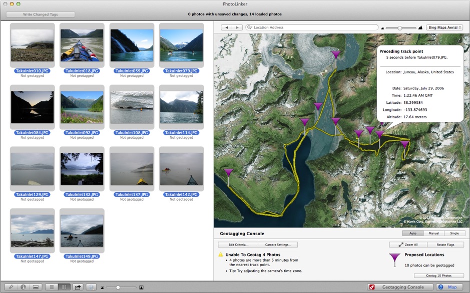
- Interactive geotagging with live updates to proposed locations as geotagging critieria are changed. Photos can also be manually geotagged by pinpointing a location on a map, entering the coordinates manually, or tagging them to waypoints.
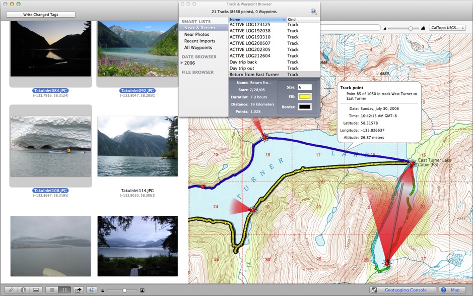
- PhotoLinker’s track and waypoint browser handles years of data and millions of track points imported from your computer or downloaded directly from your GPS receiver. Tracks are automatically cataloged by date and displayed on an interactive map where the size and color can be adjusted.
WHAT’S NEW
Version 3.5.15:
- Fixed the location search in the map toolbar.
REQUIREMENTS
- Intel, 64-bit processor
- OS X 10.9 or later
ScreenShots :


Once you clicked on the download link, a new window may popup lead you to a different website! close that window and click on the same download link again to go the download page. You may face the same thing on the download page.
THAT WINDOW IS AN ADVERTISEMENT PAGE USED TO SUPPORT THE SITE.
Using VPN will prevent your ISP from tracking your activity especially when downloading torrents, so it is highly recommended to use VPN service to hide your identity & avoid DMCA notices!! GET VPN SUBSCRIPTION NOW
If you are using Adblocker!! Please support this website by adding us to your whitelist. Ads are what helps us bring you premium content! Or read this to know how you can support us. Thank you!
Size – 15.8MB